
'Every day I see land disappear': Suriname's battle to keep sea at bay
In the dead of night on a beach in Suriname's capital Paramaribo, a group of just-hatched baby sea turtles clamber out of their sandy nesting hole and race, flippers flailing, towards the sea.
For years, endangered leatherbacks and green turtles have emerged onto Braamspunt beach to lay their eggs.
But the land spit at the tip of the Suriname river estuary is rapidly vanishing as erosion, caused by rising sea levels linked to climate change, gobbles up entire swathes of Paramaribo's coastline.
"Maybe we'll get one more season out of this," Kiran Soekhoe Balrampersad, a guide who accompanied a group of tourists on a recent expedition to see the nesting turtles, told AFP.
"But after that there'll no longer be a beach," he added dolefully.
Suriname, South America's smallest country, is one of the most vulnerable in the world to rising sea levels.
Nearly seven out of ten people in the former Dutch colony of 600,000 inhabitants live in low-lying coastal areas, according to the UN Intergovernmental Panel on Climate Change.
"Every day I see a piece of my land disappear," said Gandat Sheinderpesad, a 56-year-old farmer who has lost 95 percent of his smallholding to the sea.
Local authorities have for years been trying to find a way to hold back the tide.
"Some areas are not problematic because we have 5, 10, even 20 kilometers (3, 6 or 12 miles) of mangrove" acting as a buffer between the waves and the shore, Minister of Public Works Riad Nurmohamed told AFP.
But near Paramaribo, "there is just one kilometer so it's a very vulnerable zone," he added.
In 2020, a program to restore the capital's mangroves was launched.
UN Secretary General Antonio Guterres sought to add VIP power to the initiative in 2022 by wading into the mud to personally plant seedlings.
But five years later, Sienwnath Naqal, the climate change and water management expert who led the project, surveys a scene of desolation.
The sea is now lapping at the edge of a road and the wooden stakes to which he had attached hundreds of samplings are largely bare.
High seas carried away the substrate sediment, leaving the roots exposed.
"Over the last two to three years the water forcefully penetrated the mangroves, which were destroyed," Nurmohamed said.
The dredging of sand at the entrance to Paramaribo estuary to facilitate the passage of boats headed upriver to the port also contributed to the erosion, said Naqal.
But like the Amazon rainforest in neighboring Brazil, the destruction was also deliberate in places, with farmers uprooting mangroves to make way for crops.
- 'No time to waste' -
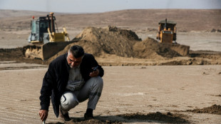
With the water lapping at the feet of Paramaribo's 240,000 people, Suriname has changed tack and set about building a dyke.
For Sheinderpesad, the levee represents his last chance of remaining on his land.
"I have nowhere else to go. When we have the dyke, I will be safer, although I'm not sure for how long," he said.
The 4.5 kilometer-long barrier will cost $11 million, which the government has vowed to fund from state coffers.
"If you go see donors it takes years before you can start to built. We have no time to waste, we'll be flooded," Nurmohamed explained.
But plugging one hole in the country's maritime defenses will not suffice to keep the mighty Atlantic at bay.
The government wants to build up the entire network of dykes that dot the country's 380-kilometer coastline.
It's just not sure where to find the money.
"It's a colossal investment," Nurmohamed said.
The country's newly discovered offshore oil deposits may provide the answer.
Last year, French group TotalEnergies announced a $10.5 billion project to exploit an oil field off Suriname's coast with an estimated capacity of producing 220,000 barrels per day.
D.Johannsen--MP


